CLOSE
CLOSE
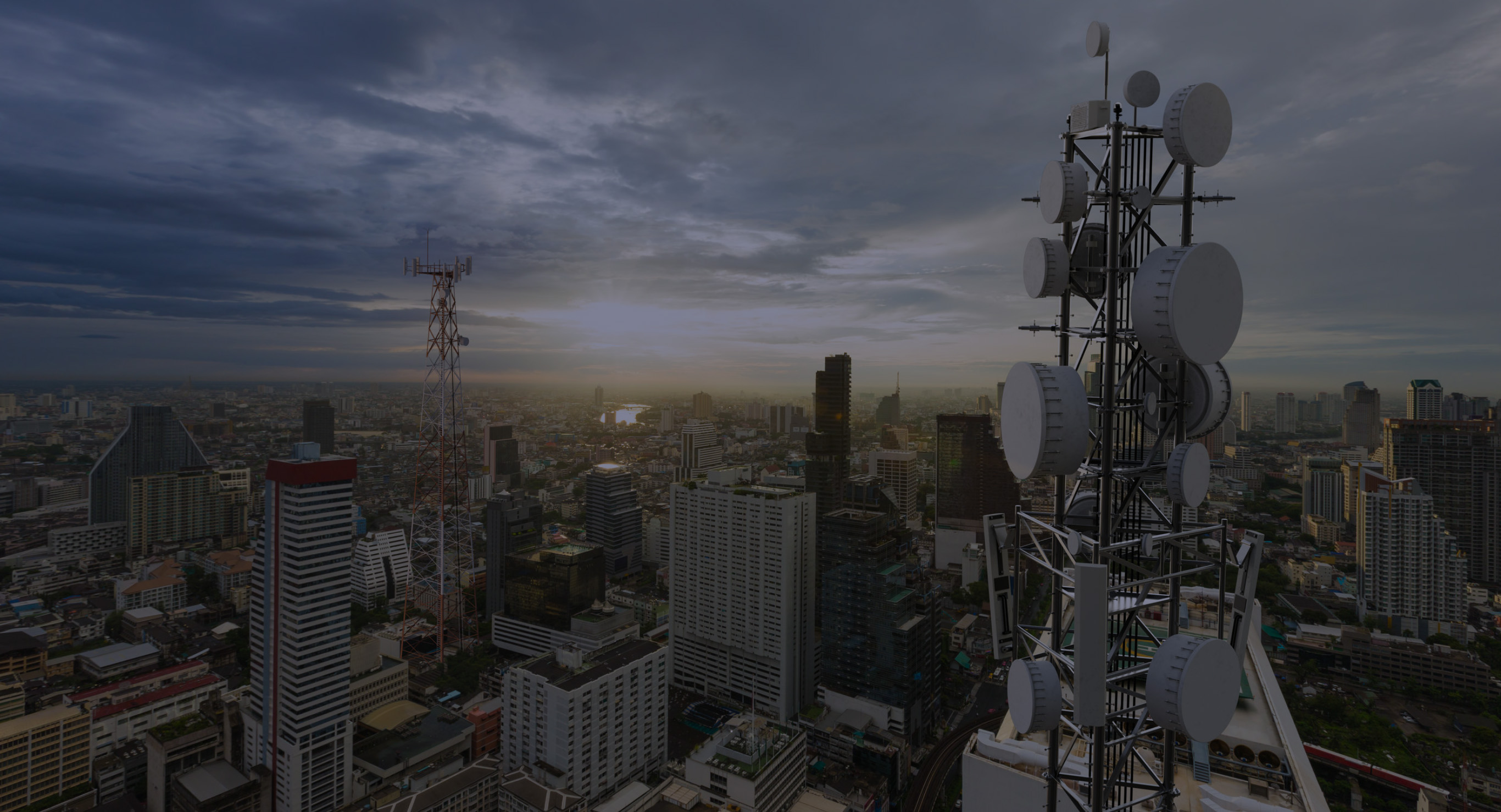


The demands on wireless networks are accelerating exponentially with more connected devices, high resolution contents and new services. The requirements to improve capacity, latency and coverage has led to network densification, where cell sites are added to handle these increasing loads. The AW3D Telecom is a cost-effective, next-generation 3D bundle that helps you design your wireless networks for optimal performance.
AW3D Telecom provides the benefits for the Radio Area Network (RAN) design and optimization with the Radio Frequency (RF) planning software used in the mobile network operators and communication service providers.
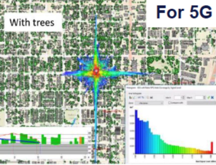
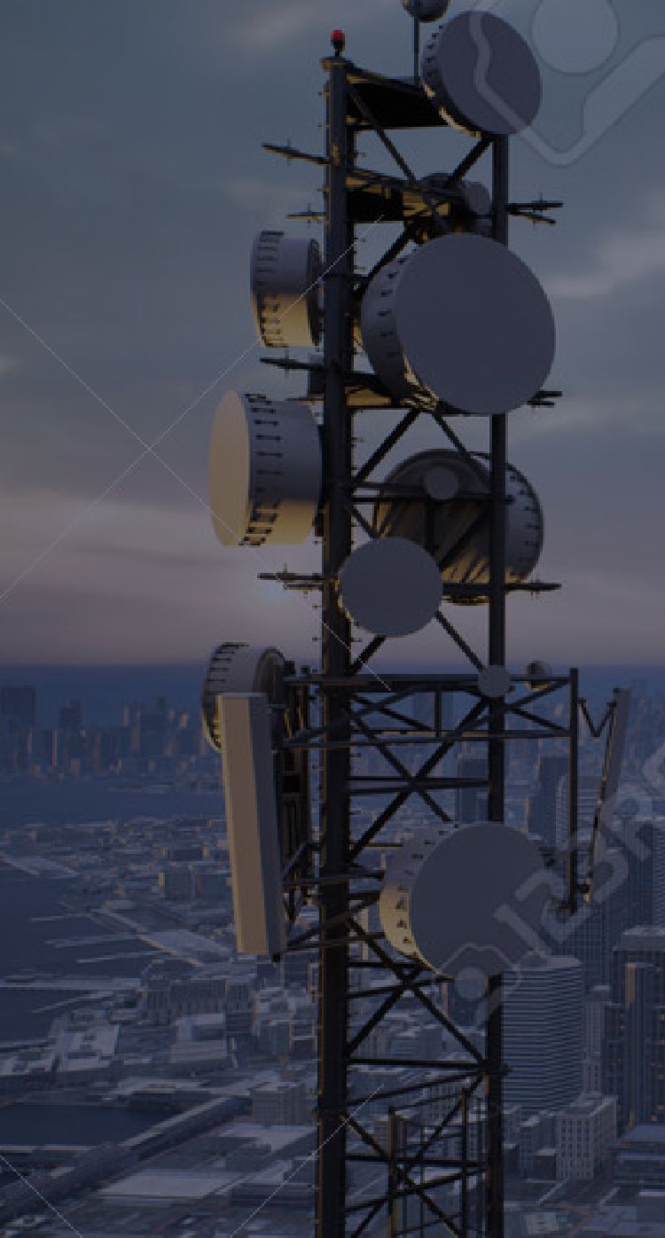
AW3D Telecom RF simulation for 5G service


Please visit here for more details!
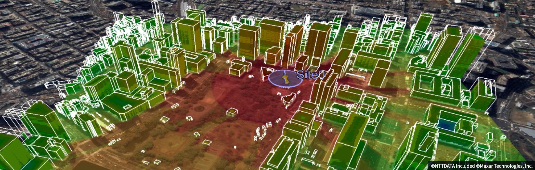
Advanced 3D digital map package for 5G compatible with global standard wireless network design software used for radio frequency (RF) simulation.
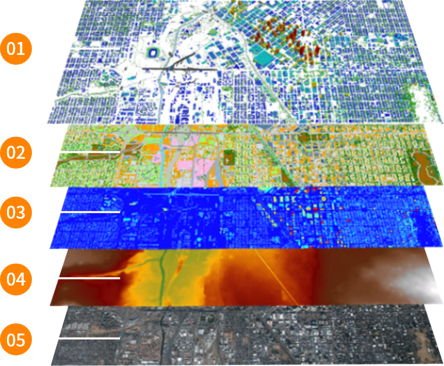
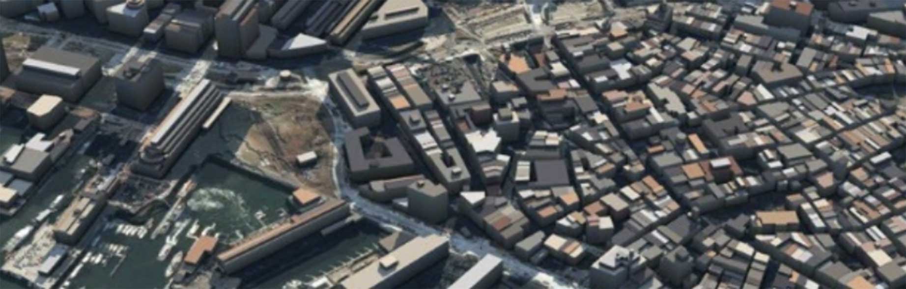
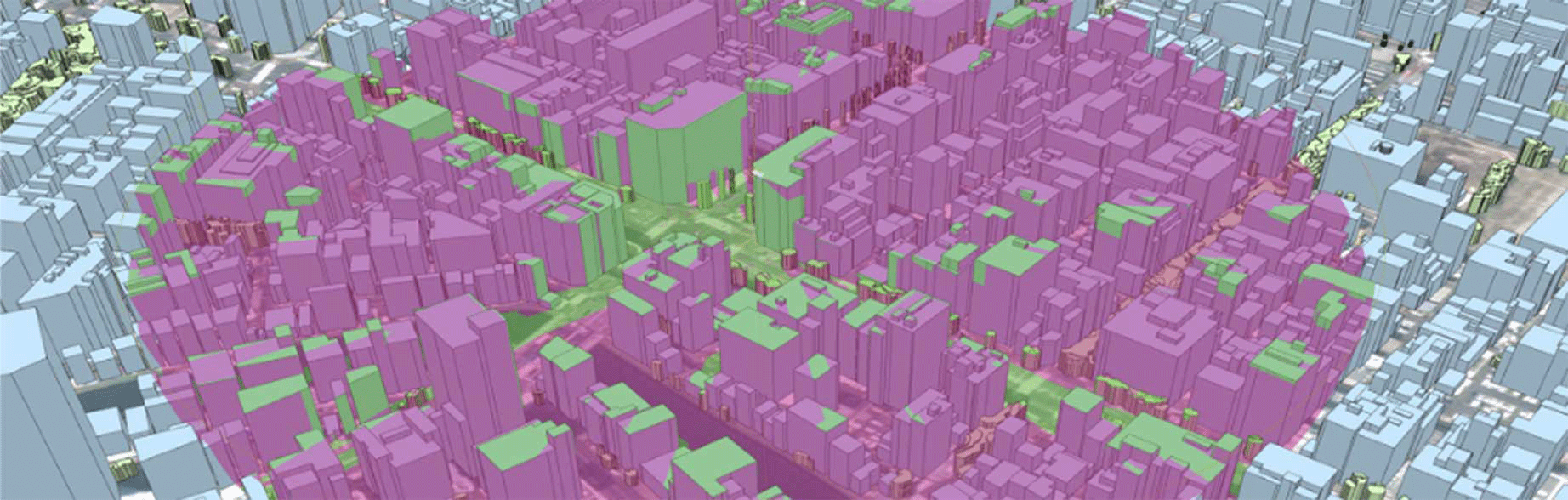
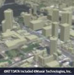
These dataset are developed from high accurate building footprint and elevation model. 3D vegetation and bridge can be offered as well
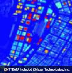
Land-use classification map for analysis of radio propagation and deviation
Height model expresses the height of the buildings vegetation, and others from the ground. Its is also referred as “2.5D model”.
Bare-earth 3D elevation model in raster format, height of buildings, vegetation, bridges are extracted from digital surface model.
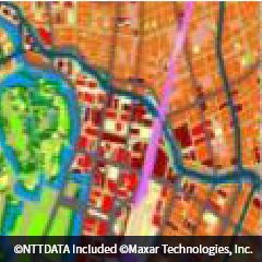
A high-resolution orthorectified imagery for base map to display AW3D Telecom for 5G dataset.
Vodafone is focused on building a digital society for the
future and is using its 5G core in the UK to make this happen.
“Using AW3D satellite map data supplied by NTT DATA, we were able to model the performance of the 5g network and the impact of the environment including; buildings, bridges and vegetation. We achieved this by modelling the entire country in 3D to assist, for example, we were able to understand where to optimize the network and place new 5G towers.”
The Telecom Dataset has been used by major mobile network operators around the world and can be used by all customers involved in wireless network planning and simulation. Some typical use cases are as below.
© 2023 NTT DATA Japan Corporation included Maxar Technologies,Inc.
| Usage | 5G Base station design |
|---|---|
| Project Summary |
|
| Reasons why AW3D choosen |
|

| Usage | Simulation of private 5G network using CBRS band |
|---|---|
| Project Summary |
|
| Reasons why AW3D choosen |
|
High quality 5G mobile network design
| Usage | 5G wireless network design and simulation |
|---|---|
| Project Summary |
|
| Reasons why AW3D choosen |
|
| 3D Vector | DHM | DTM | DLU | ||||
|---|---|---|---|---|---|---|---|
| General description | 3D model of building, vegetation and bridge |
Height model of building and tree |
Terrain elevation Model |
Land Use Map | |||
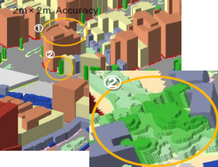
| Spatial resolution | ー | 1m/2m/5m | 10m/20m | 1m/2m/5m | 10m/20m | 1m/2m/5m | 10m/20m |
| Horizontal accuracy (RMSE) |
2m | 2m | 10m | 2m | 10m | 2m | 10m |
| Vertical accuracy (RMSE) |
1-2m | 1-2m | 5m | 1-2m | 5m | ー | |
| Standard File format | Vector (TAB or Shape) |
Raster (BIL or MRR) |
Raster (BIL or MRR) |
Raster (BIL or MRR) |
|||
| Product Image | 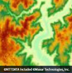 |
 |
 |
 |
|||
*RMSE: Root Mean Square Error
Compared to aerial photography, it offers great
value for money.
Please contact the following for sample data,
detailed data information, or questions regarding business use.
